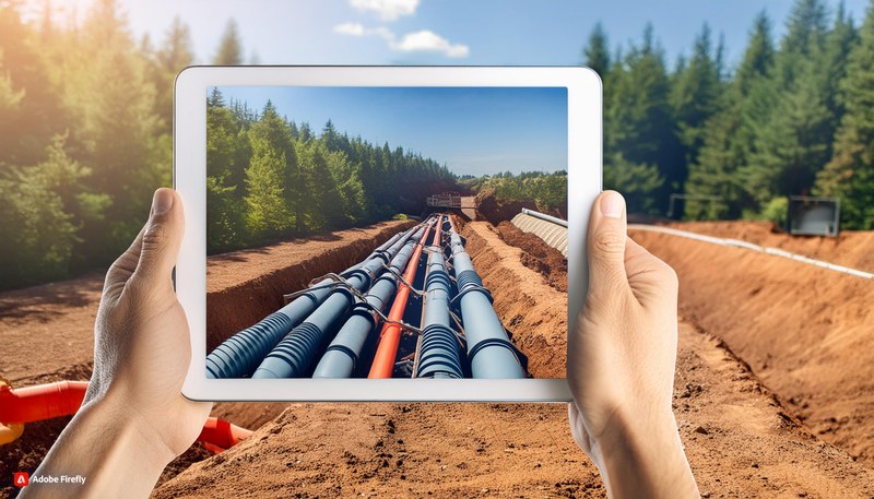
Field workers often make decisions by mentally translating 2D maps into complex real world environments. This project explores how Augmented Reality can support more intuitive, in situ interaction with geospatial data. Grounded in user research, it aims to improve spatial understanding and decision making directly in the field.
Testimonial
Geospatial fieldwork relies on accurate spatial understanding—yet most decisions are still made by interpreting flat maps on small screens in complex real world environments. Even with powerful mo-bile GIS tools, translating 2D representations into 3D reality on site remains challenging, time consuming, and error prone.
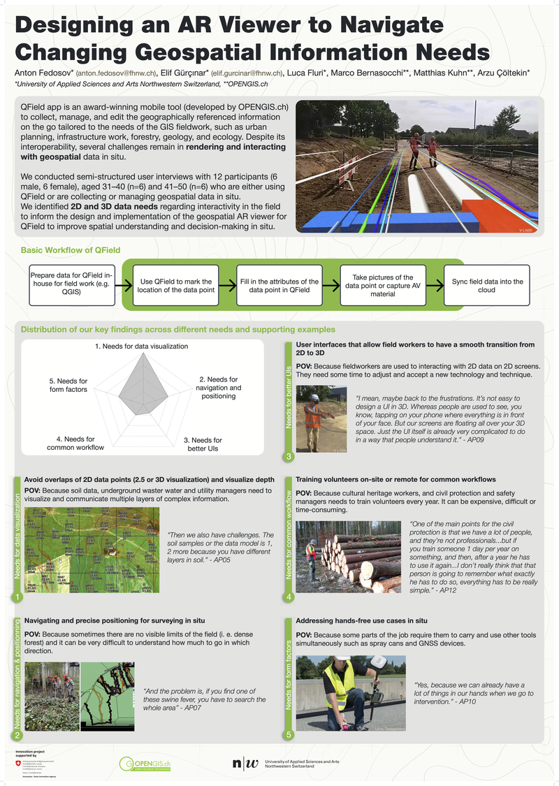
QField, an award winning open source mobile GIS application developed by OPENGIS.ch, is widely used across domains such as urban planning, infrastructure maintenance, forestry, geology, ecology, and emergency response. To better understand how geospatial data is used in practice, the project builds on an in depth user study with 12 experienced field professionals from diverse sectors, including utility management, cultural heritage response, fire brigades, soil data collection, and GIS management.
Despite disciplinary differences, the study reveals a shared workflow: geospatial projects are prepared centrally in QGIS, deployed to QField for fieldwork, and enriched on site through annotations, attribute editing, media attachment, and synchronization. At the same time, recurring challenges were identified—particularly regarding spatial understanding, interaction with layered 2D and 3D data, and the interpretation of underground or volumetric structures in situ.
Building on these insights, the project investigates how an Augmented Reality (AR) viewer for QField can improve spatial comprehension and decision making directly in the field. The focus lies on identifying concrete 2D and 3D interaction needs, appropriate visual representations of geospatial data, and suitable form factors such as handheld devices or head mounted displays. The project further explores technical feasibility, prototype design, and integration into existing QField workflows.
The outcome is a research grounded foundation for extending QField with AR capabilities—supporting more intuitive, accurate, and context aware interaction with geospatial data where it mat-ters most: on site.
Project details
- Type
- Research project
- Research areas
- Digital Experience Design
- University
- FHNW School of Computer Science / Institute of Interactive Technologies
- Partner
- OPENGIS.ch
- Funding
- Innosuisse
- Running time
- 16.08.2024 - 15.08.2025
- Management
- Anton Fedosov
- Collaboration
- Elif Gurcinar,
Luca Fluri
Contact
Prof. Dr. Anton Fedosov
- Phone
- +41 56 202 81 37 (Direct)
- anton.fedosov@fhnw.ch